


There once were three legendary Great Fires deriving directly from Ahura Mazda, existing from the moment of creation on to support the Zoroastrian faith, one of the first monotheistic faiths in history, dispel doubt, protect all humankind and make miracles happen. Even the mighty Sassanid rulers humbled themselves before those fires in order to ascend the throne. Each great fire to its own, the venerated Adur Farnbag, hidden to the south of empire, has made its place among the priests, Adur Burzen-Mihr of Khorasan shone its light on the farmers, and the mighty Adur Gushnasp, the mountain one, belonged to the warriors. The Great Fires were burning for thousands of years, being pride and joy of the Zoroastrians.
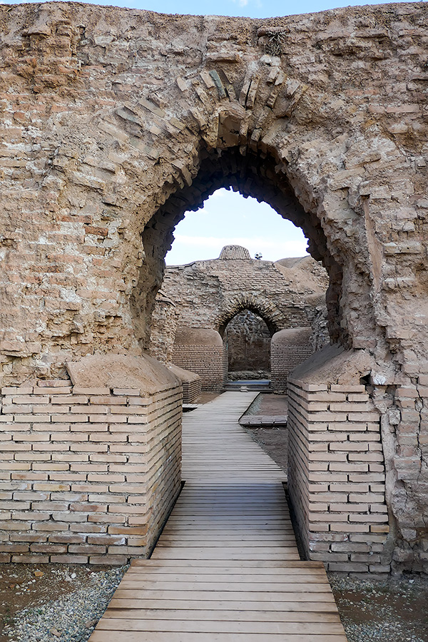
I was looking at the place where Adur Gushnasp crumbled into ashes. The outstanding world heritage site of Takht-e Soleyman lay in front of us. The ruins of religious and secular buildings lie on a limestone outcrop at the altitude of 2.200 m ASL, fortified by oval walls that measure approximately 380×300 meters. And in the centre of the little plateau is the magic eye – a beautiful thermal spring lake with water temperature of 21°C. At its longest the lake stretches about 120 meters far, its maximum width being about 80 meters. But it’s the depth of this water-filled abyss that makes your jaw drop – 112 meters. Unfortunately the water is too murky to gaze into the depths… and I must admit that the idea of diving down into the bowels of the earth sent little chills down my spine.


Before becoming the home of the Great Fire, this spectacular location was inhabited as early as the 5th century BC. Intramural graves of deceased dogs and humans were discovered. Not until the Parthian period the fortifications were made. Before the Arab-Islamic conquest of the lands the name of the region and the now city of Takab was Shiz, and the temple was simply called Azar Gushnasp. The biblical name Takht-e Soleyman or literally the Temple of Solomon came to use only after the Muslim conquest. Some legends say that the name derives from King Solomon imprisoning monsters in the nearby abyss of Zendan-e Soleyman, others claim that the Zoroastrians themselves renamed the temple to the name of Solomon hoping that the invading Arabs that held King Solomon as a prophet in high esteem would not dare to raid the temple. Whichever holds true, the fire of Adur Gushnasp continued to burn at least until the Mongol invasion in the 13th century AD. The second Mongolian Il-khanid ruler of Persia Abaqa Khan displaced the inhabitants of Takht-e Soleyman and build a pleasure palace upon the foundations of the ancient Zoroastrian sanctuary. And then the place slowly fell into decay.


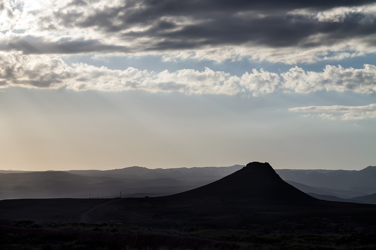
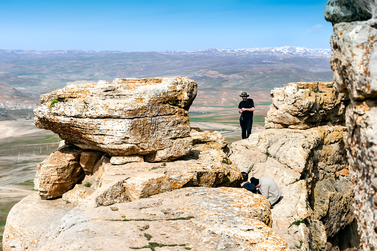
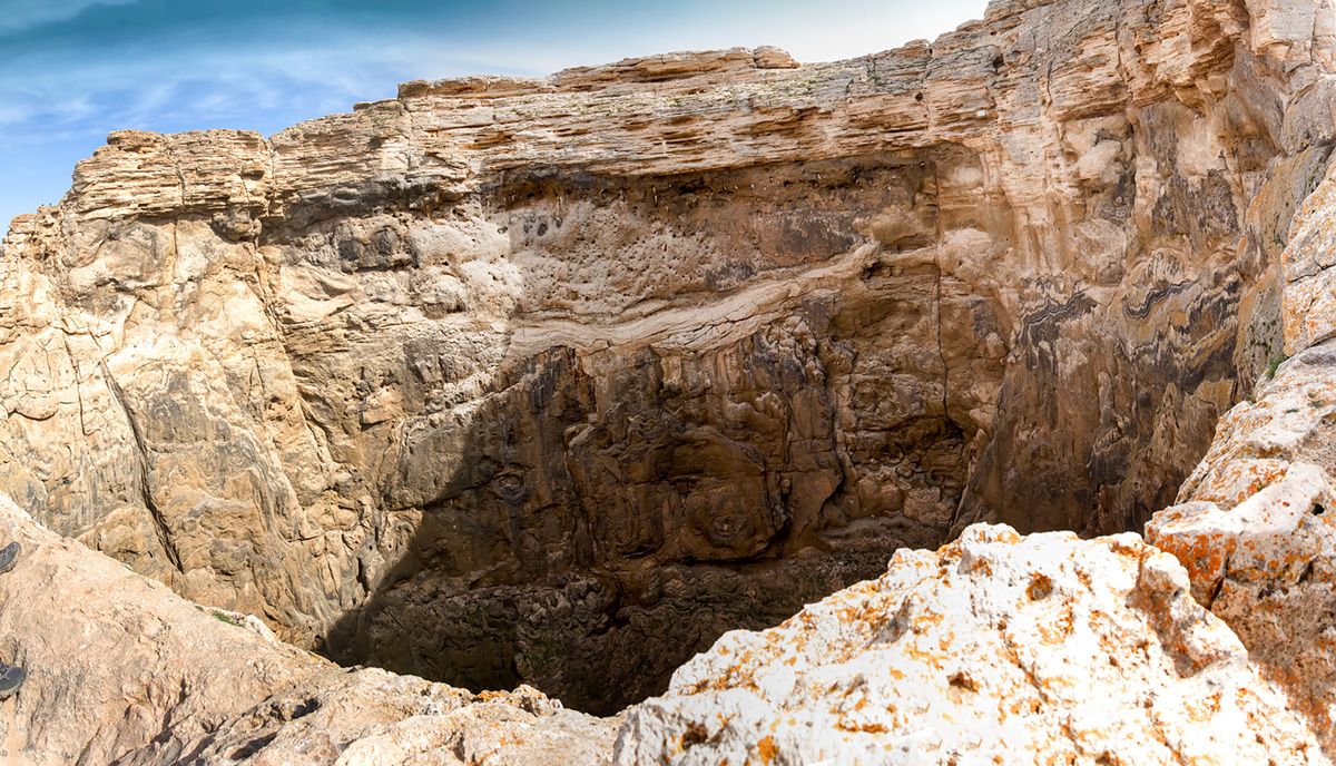
But good three kilometres to the west the Prison of Solomon is still standing. Prison Mountain, or Zendan-e Soleyman, is a dormant volcano rising up to 107 meters above surrounding landscape. But the true surprise comes when reaching the top or the mountain – a great hole some 65 meters in diameter and over 80 meters in depth opens before your feet and it’s hard not to feel your knees shake as you stand over the vertical walls and stare down to the bottom. It is quite easy to imagine how the mighty son of David, King Solomon, wrestled with monsters that ended crushed and imprisoned at the bottom of the pit. Where the walls are at their lowest, there once stood a holy temple, dating to the first millennium BC, when there was still a lake at bottom of the pit. Now only the cries of jackdaws and sparrows that nest in the walls of the pit broke silence. The spring of the lake is buried under rocks, but the water is still flowing. The spring bears sulphuric gasses that add to the image of Inferno of the lonely mountain laying in the middle of the scorched land. To the east the lake of Takht-e Soleyman reflects the rays of the rising sun.

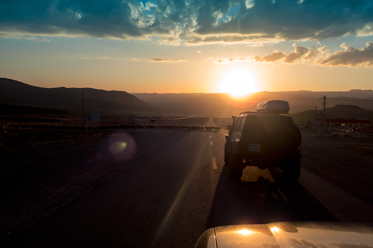
It took us almost one whole day to reach the location of Takht-e Soleyman from our bivouac at the Lake Urmia shore, mostly because we lost over two hours trying to get some street food around the town of Shahin Dez. Unfortunately instead of typical kebab we voted for Iranian pizza. That took time… and the results were, how can I say… interesting J But the vehicles worked well that day, we got diesel fuel in Shahin Dez without much trouble, and our bivouac in the beautiful green valley just by the river was nice, though quite cold being nearly 2.000m ASL. After spending an hour manually rotating the tyres of my Landcruiser (to achieve even wear) I even managed to take a swim in the cold river, trying hard to ignore all the plastic pollution. We visited the ruins of Takht-e Soleyman in the afternoon of the day we arrived, and climbed to the top of Zendan-e Soleyman the next morning.


Useful information:
Takht-e Soleyman parking entrance coordinates are N36° 36.121′ E47° 14.163′. The price they charge for parking is 30.000 IRR (0,49 €) per vehicle, keep in mind they are not quite inclined to return the change. Thanks to Izabel we knew how to say thirty thousand (si hezar) in farsi and thus got the overpayed 20.000 IRR. We payed with a 50.000 IRR note and the guard just thanked us… at first. The entrance fee to the Takht-e Soleymn site is 200.000 IRR (3,24€) per person.
The top of Zendan-e Soleyman can be reached from the by-the-road parking at N36° 36.695′ E47° 12.077′. The entrance fee is 80.000 IRR (1,29 €) per person. Average person can reach the top in 15 minutes.
The last kilometres of the valley leading to Tahkt-e Soleyman from the main road near Takab, before the village of Ahmad Abad, offers many nice spots for bivouacs. The banks of the river are mostly grassy and some trees even offer shelter. But keep in mind the altitude. We woke to see hoarfrost on our tents and equipment. Also the ground is quite soggy close to the river and not every place is suitable to pitch a tent. Not to mention the trash… the river carries the plastic waste from the villages upstream. The evidence hangs from the branches of the trees and is buried in the alluvium. We spent the night at N36° 36.786’ E47° 07.279’.
The distance driven that day from the Lake of Urmia was 362 kilometres.
The price for Iranian pizza (6x including drinks and bread – for our whole group) war 350.000 RLS (5,66€).


Iran 2018 pt.4 – Towards Kurdistan via Karaftu Caves – Destination: Overland
[…] descending from Zendan-e Soleyman we hit the road towards the town of Marivan near Iraqi border. Approximately 50 kilometres after […]