


Being very tired from the long transfer, it took me some time to fully appreciate that immediately after the crossing of the border from Turkey to Iran the impressions and feelings changed, and for the better, much better. It was a very welcome feeling and my depleted energy levels were considerably raised. But I needed a few days to get used to Iranians blowing horns and waving at us while we were driving. My initial reaction was to question myself what the hell did I do wrong? But no, the Iranians were just kind, friendly and wanted us to feel welcome in their country. Where are you from?” and “Welcome to Iran!” were phrases we had to get used to, as we had to get used to the feeling that we were tourist attractions for Iranians. Quite a different feeling than in Turkey that still couldn’t hide the truth of being an army-occupied country just after a coup d’état.
We spent the night at the shore of Lake Urmia just after the crossing of the bridge on the highway from Urmia to Tabriz (N37° 48.485’ E45° 24.852’ – not much of a place for a bivouac, but close to the road, easily accessible and the concrete walls of beach huts provide some shelter from the winds).
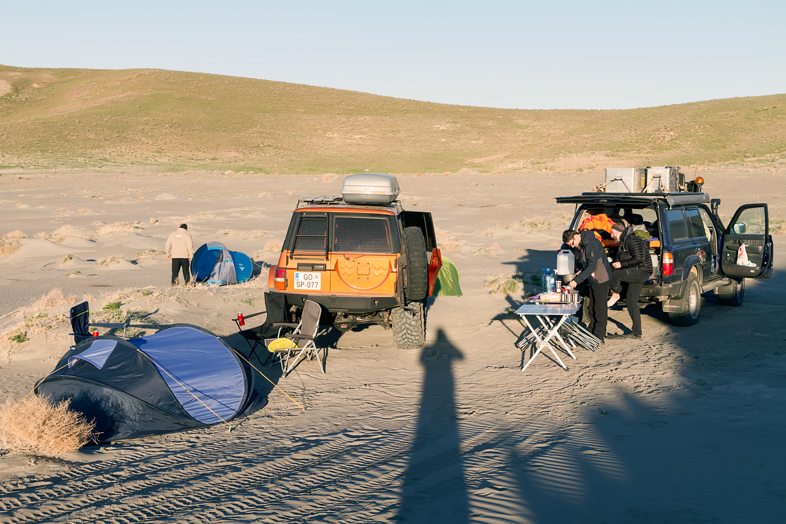
The friendliness and hospitality of Iranian people demonstrated itself very often, this time in the form of not having to pay the toll for crossing the bridge. “You are my guests”, the nice tollbooth official said. “Welcome to Iran!” Not so welcoming was the storm that caught us just while making dinner at our campsite. The wind was so strong that it lifted the sand grains from the lake shore and sent them shooting at us. No wonder we quickly packed our belongings and found shelter in tents and cars. But before the storm there was enough time for a beer. After all, we were in Iran. After five days of driving, after two years of planning, and after nine years of dreaming it – the wheels of my faithful Land Cruiser felt the sacred grounds of ancient Persia. Finally the dreams born from the tales of Karl May, Uroš Ravbar and other overlanders were coming to life for me, for us.
Our first morning in Iran was dedicated to procuring all the necessary things – exchanging euros for local currency, getting local phone cards, buying the provisions. That’s why we headed back to Urmia. Urmia, as the name is pronounced in Kurdish, or Orumiyeh in Persian, is the 10th largest city of Iran, inhabited by approximately one million people, is the capital of the West Azerbaijan province, and the trading center for a fertile agricultural region where fruits, especially apples and grapes, and tobacco are grown. It lies 1.330 m above sea level.

The traffic in Iran is something worth experiencing. What initially seems as total chaos is actually a very fluent and effective way of moving. No matter if five cars simultaneously occupy the road with only two lanes. The traffic laws are obviously more guidelines than actual rules. But it works. You just have to catch the rhythm and go with the flow. It feels like dancing.
It took us a while to reach the city centre, park the cars and find a place willing to exchange our euros for rials. Not all the banks are allowed to do the exchange, only a bank named “Melli Bank”, and even that one in not all the offices, can do the trade. But before we reached the proper bank, we found a privately owned currency exchange bureau. The owner was very friendly, though he barely managed to have enough of local currency needed for our euros. Afterwards his aide took us to the office of Irancell company to get our local telephone numbers.
I liked it in Urmia. The city is big, quite green, full of people, full of markets. The vibe is good. The people seem well-spirited, running around in the thick crowds so characteristic for oriental cities. The smells of spices, tobacco, tea, traffic, all mixed together, made me remember the souks of North Africa. But it was cleaner, better organised and less crowded. The fresh mushrooms, spices, fruits and meat all looked quite delicious. It felt good to be there.
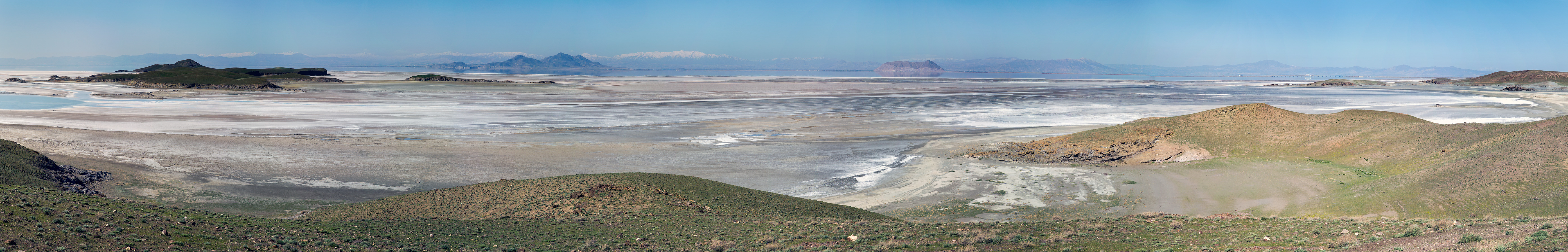
Etymology suggests Urmia means “Watertown”, quite a handy for a city situated by a lake and surrounded by rivers, a kind of “cradle of water”. When our way took us over the bridge at Lake Urmia again towards Kandovan. At its greatest extent, Lake Urmia was the largest saltwater lake on Earth, with a surface area of approximately 5.200 km2 with length of 140 km and width of 55 km, and a maximum depth of 16 m. The lake has shrunk to 10% of its former size due to damming of the rivers that flow into it, and the pumping of groundwater from the surrounding area. The plans for saving the lake, which holds only 5% of its initial water, are in progress, hoping to prevent the disaster that struck Aral Sea. But the lake is still a place worth visiting, with beautiful vistas that appeal to photographers, and the locals like to visit it and spend there their free time.


Leaving Lake Urmia our first sightseeing stop was the rural village of Kandovan. The distance from the city of Urmia is 145 km, and the village lies in a fertile green valley full of walnut trees at the height of 2.000 m ASL. The main road to the village is superb, but the road following the river flowing down from Kandovan and passing several villages is much more scenic, though a bit narrow and can be a challenge if you encounter trafic going to the opposite direction. Kandovan is a village known for its manmade cliff dwellings which are still inhabited. The cone-shaped houses in the steep cliff face are often compared to Turkish Cappadoccia. Maybe on the first look, but Kandovan is, despite many visitors, still a village that lives its own life. The troglodyte homes, excavated inside volcanic rocks and tuffs, are still inhabited by approximately 600 people, the narrow steep streets are populated by goats, donkeys and dogs. Take care, because their excretions litter the cobblestones. The tourist impact is especially noticeable at the bottom of the valley where many restaurants and cafés and souvenir shops are concentrated. Many shops sell plastic water containers because the spring water coming from a well in the village is considered beneficial for the health of the body and soul.


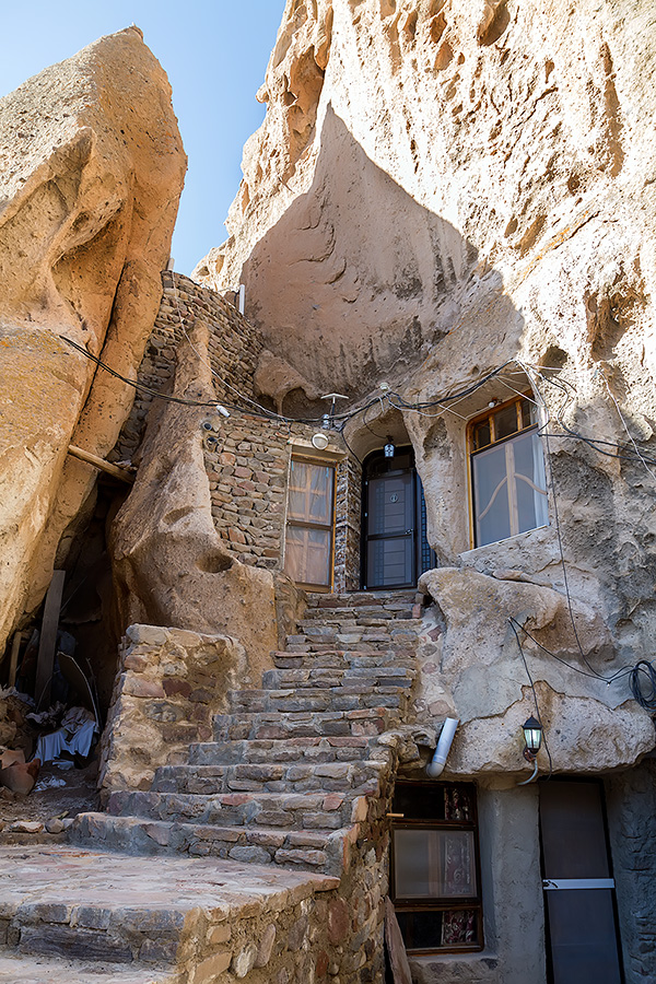
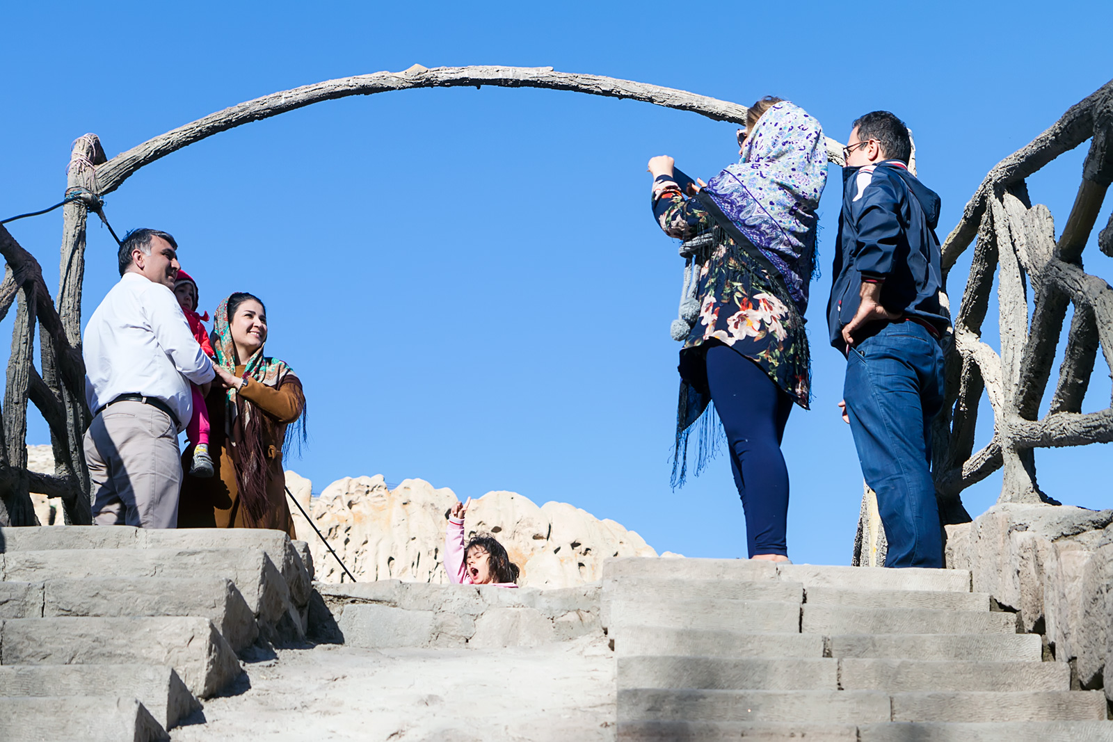
To be honest – the village of Kandovan was nice. Hidden at the end of the valley, surrounded by walnut trees, still living its peaceful life like it has for centuries, not minding the tourists much. Frankly, most of the Iranians that visited the village didn’t even bother to walk around the houses. They just took photos at the bridge, went for a tea, and drank water from well. Just those weard European guys were climbing the steep streets and looking for a path to the opposing valley ridge to take photos.


We spend the night again at the shores of Lake Urmia again, near the salt pans at the eastern shore of the lake, south of Islami Island, in a nice sandy bivouac quite well protected against the winds (N37° 44.757’ E45° 28.365’). It’s soooo good to be finally able to bury your feet in the sand.
Useful information:
Exchange rate was 61.800 rials (IRR) for 1€. Passport copies were required to perform the exchange. Iranians often cite prices in its former currency “toman”. One toman equals 10 rials and a visitor must be very careful when bargaining for a price.
The Irancell local telephone card costs 150.000 IRR (2,43€), 8Gb worth of data transfer is 350.000 IRR (5,66€). Written contract and a copy of the passport is required to obtain a SIM card. Facebook and many other internet sites are blocked in Iran, therefore it is advised to obtain a proper VPN service membership before entering the country.
Toll for the Lake Urmia causeway and bridge was 40.000 RLS (0,65 €).
Distance between city of Urmia and village of Kandovan is 145 kilometers – about 2,5 hrs of driving.
Parking fee in village of Kandovan is 40.000 IRR (0,65 €) per car. There was no fee to visit the village itself. Coordinates of the parking place are N37° 47.758′ E46° 14.716′.
In the town of Ilkchi we went shopping. The price of bread was 10.000 IRR (0,16 €).enough for 4 people), 10 pcs of eggs were 60.000 IRR (0,97€, they weighted them and then named a price). Watermelon costs 900 – 1.500 IRR (0,015 – 0,024 €) per kilogram.
Great place to take panoramic photos of Kandovan is N37° 47.588′ E46° 14.862′.


Iran 2018 pt. 3 – Of the Temple of King Solomon – Destination: Overland
[…] took us almost one whole day to reach the location of Takht-e Soleyman from our bivouac at the Lake Urmia shore, mostly because we lost over two hours trying to get some street food around the town of […]