


Mesopotamia… Tigris… Kurdistan… most people just hear about those names and places and civilizations in school, maybe later on TV, and never even bother to find them on a map, let alone visit. West of the iranian city of Sanandaj, the forbidding mountains and steep valleys form a dramatic border zone between Iran and Iraq, home to stacked villages, and territory of smugglers and military. Further west there lie arable lands irrigated by rivers of Euphrates and Tigris, cradle of ancient civilisations. The Sirwan or Diyala river that we were heading to see flows down to Tigris, a river that saw mighty battles between Assyrians and Elamites nearly 3.000 years ago, and the memories of the stories of Karl May came drifting through my mind. We were going to the Kurdistan mountains, to the area of Kurdish tribes, to the river that flows past the graves of Haddedin sheikh Mohammed Emin and the faithul black arab stallion Rih, The Wind.
Tell your your friends or family that you are heading for Iran and an awkward cringe will be drawn across their face. Tell most Iranian city dwellers that you are destined for Kurdistan, and they’ll make neck-slitting actions accompanied by gruesome sound effects. But people who were in Kurdistan tell the contrary – that the Kurdish were incredibly friendly and hospitable people. This, and the incredible mountain scenery, is the reason why we added Hawraman to our travel itinerary.
Iranian Kurdistan or Eastern Kurdistan, in Kurdish Rojhilatê Kurdistanê, is an unofficial name for the lands of northwestern Iran inhabited by Kurds which borders Iraq and Turkey. It includes urdistan Province, Kermanshah Province, West Azerbaijan Province, Ilam Province and Hamadan Province. Kurds generally consider Iranian Kurdistan to be one of the four parts of a greater Kurdistan, which also includes parts of southeastern Turkey (Northern Kurdistan), northern Syria (Western Kurdistan), and northern Iraq (Southern Kurdistan).
The Kurdish people have inhabited the northwestern region of Iran for centuries – dating back before the Islamic conquests of the 7th century. The early Kurdish principalities became caught between the rise of the Safavid empire in Persia and Ottoman empire to the west and were displaced and marginalized during the ensuing wars between these two empires. The fight for Kurdish independence even led to the deportation of Kurds from western Kurdistan to North Khorasan, a refion in northeastern Iran, where Kurds still live today. Rare were the valleys where Kurdish tribes could live peacefully and built their homes, elsewhere they just led the nomadic life. The fight for Kurdish independence is not yet over, and today the conflict remains as bloody as ever Iran sees armed Kurdish groups as existential threats and has engaged, same as Turkey, in everything from assassinations, cross-border raids to Iraq, detentions and executions to silence the organizations.
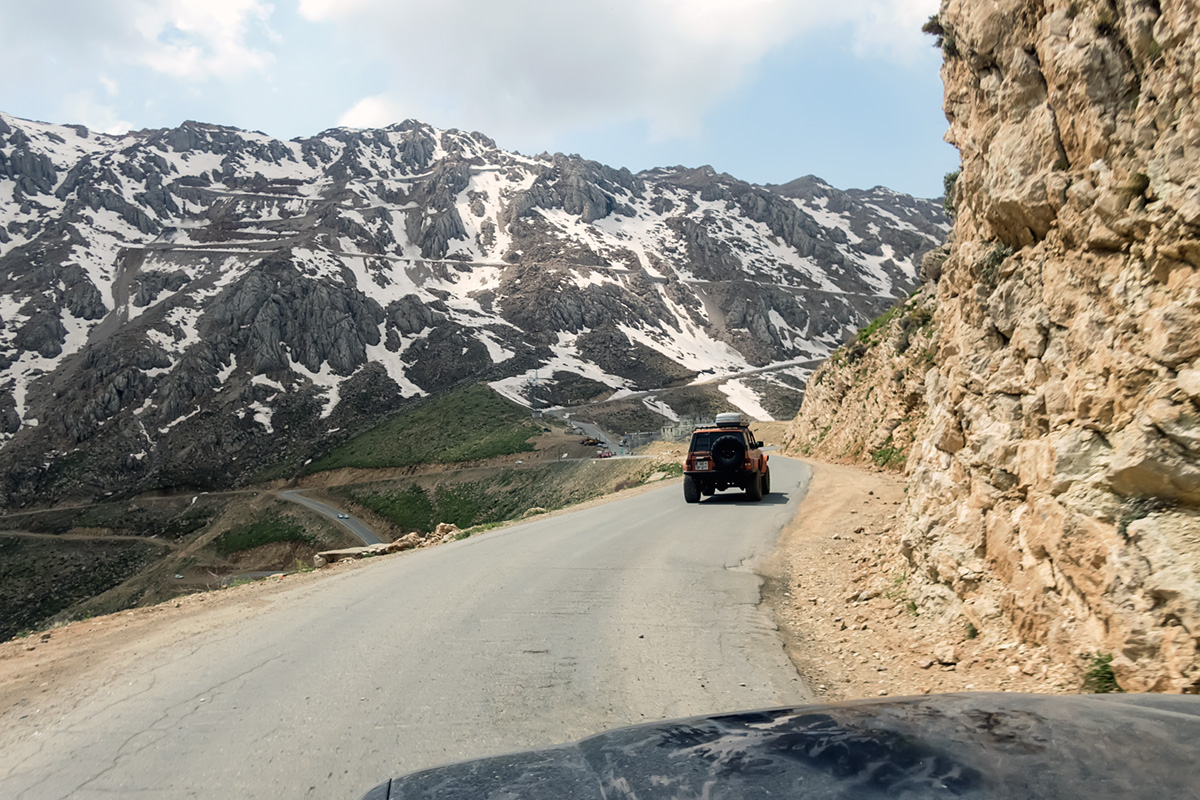
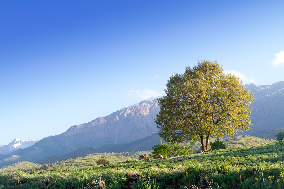
But none of that affected our journey from Marivan through Hawraman valley towards Paveh. Some 7 million of Kurds represent about 10% of Iranian population and are considered as very honourable and hospitable people among travellers. As we were entering the mountains we could see a lot of springs and rivers. It was still springtime and the slopes of the mountains were all green, giving plenty of grazing for sheep. But the peaks, reaching up to 3.000 m ASL, were still covered in snow and ice. Travelling just a few kilometres from the Iraqi border I was expecting army checkpoints and questions where were we going, but nothing happened. We obviously didn’t bother anyone. Army posts are visible all along the border, and stone watch towers and small military camps have even been constructed right on the mountain ridges that look down into Iraq.

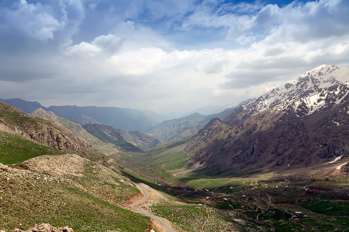
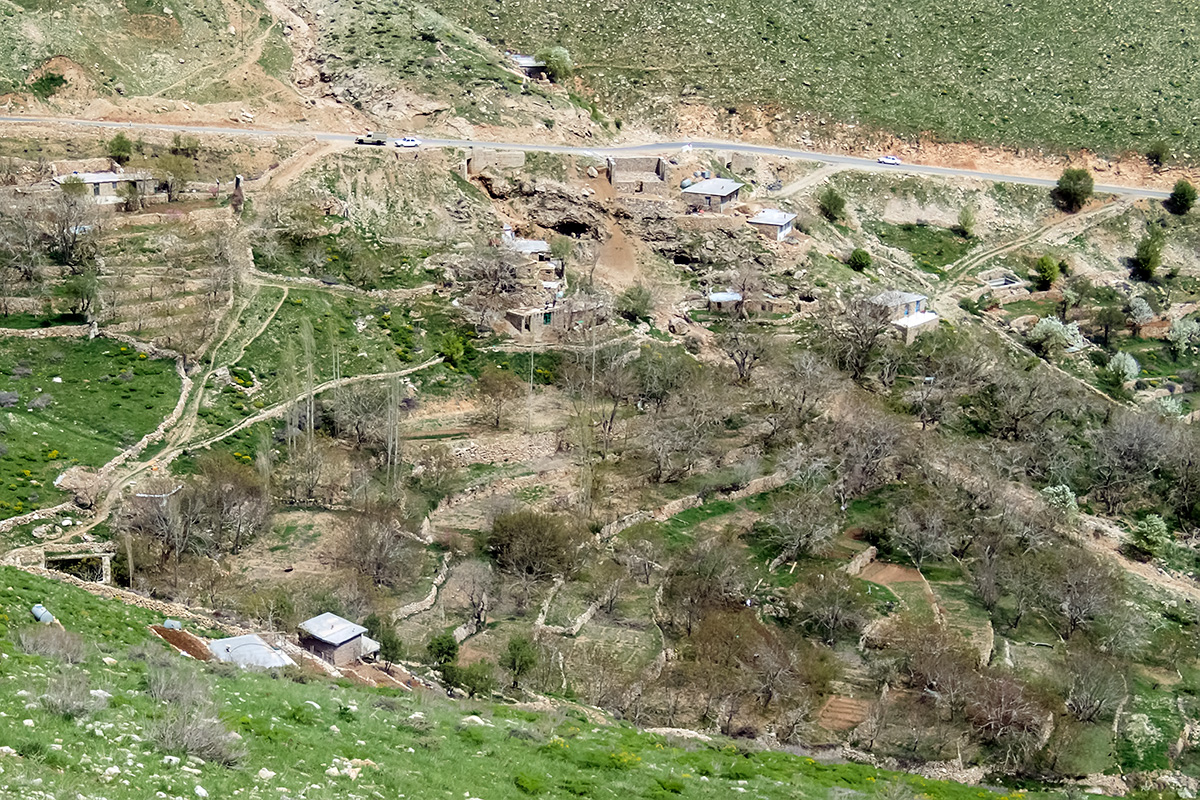
The good tarmac road was slowly climbing up. Distant villages were hidden in the fold of mountains, around the villages some terracing has been developed, allowing for agriculture, and higher up absolute nothingness, nobody, not even sheep. Just rocks and snow and ice. As we slowly approach the pass, I can see the road climbing high up to the icy slopes. This is the new road to Paveh. But we turn into the Hawraman Valley, the heart of Kurdistan.
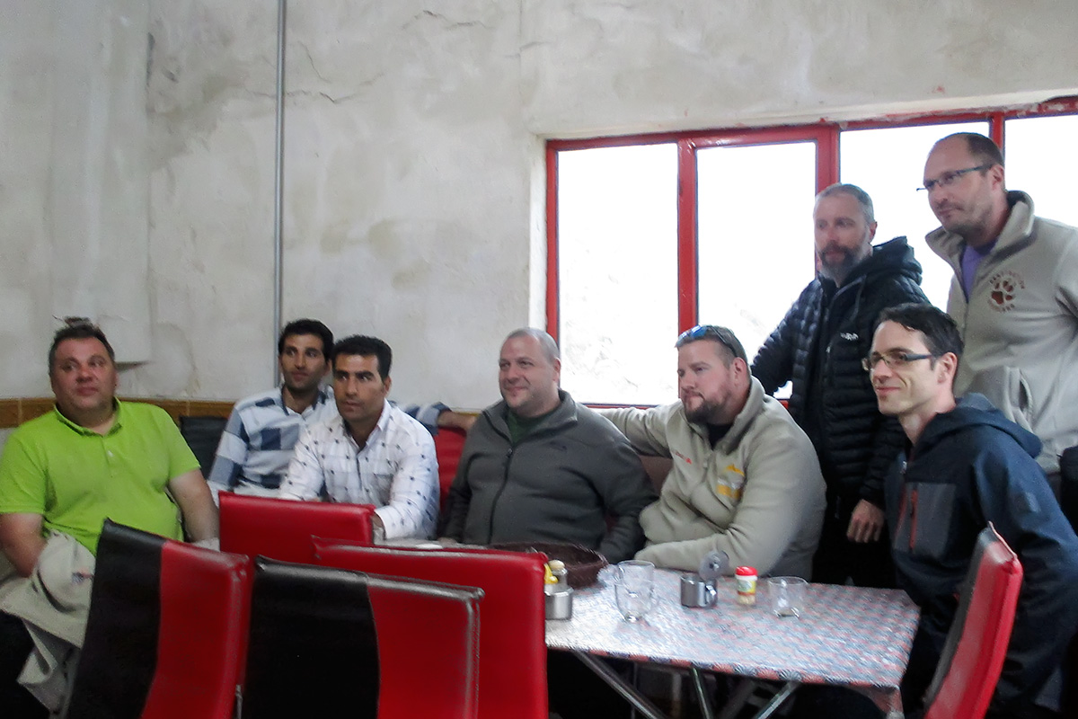
As we stop by the road to admire whe view, we are joined by the Kurdish family. Language is not a barrier the smile couldn’t overcome and soon we take photos together. Their kids climb to the hood of my Toyota and the parents take photos. So do I. Waving hands through the car windows they dissapear along the road we came from.

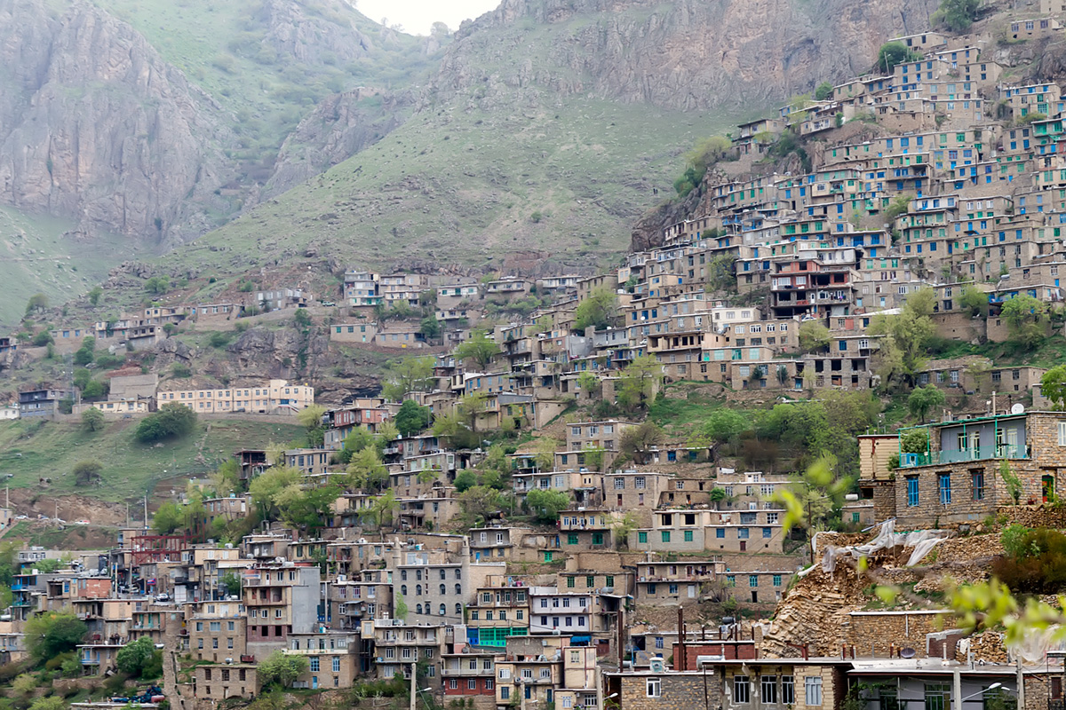
Down the first hairpin bends we descend to the village of Hawraman-at-Tahkt. Hawraman is popular for growing walnuts because the region’s geography is very suitable for their growth. Exporting walnuts brings important revenue to Hawrami people. Hawraman-al-Takht, the largest and most beautiful village of the valley, is, in the absence of a decent piece of flat land, built against the steep slopes. The roof of one house serve as garden of the house that is built above. We stop for lunch in a local shop, of course kebab is on the menu. »Hi there, how are you, where are you from, welcome to Hawraman…«, locals seem flattered and proud to welcome us. Unfortunately the languagge barrier and the lack of our time doesn’t allow us to develop confersation much further, but they tell us that the road continues further down the valley and that we can reach Paveh. Later we drink tea on the terrace of a teahouse by the road with great views on the village and the upper valley. The owner smiles at us and smokes shisha. Other guests take photos with us. Smiles everywhere. I watch through the windows how a rainstorm comes in from the mountains.

Just past the village of Hawraman-al-Takht is the Pier Shaliar shrine, hidden in the beautiful village cemetery covered in trees, walnuts among them. People tie the cloths to the tree branches to make a wish, a habit rarely seen among believers of Islam, but the place is very popular for it.

The rainy clouds stick to the mountain tops, raindrops fall and wind starts to blow and as we continue our descent through Hawraman valley. The environment is becoming more and more spectacular. We drive via hairpin road from pass to pass, and from every pass we have again a beautiful view on the next part of the valley. Sometimes we pass a small village or see other villages higher up the mountains. I wish we had time to visit them, the roads leading up the slopes seem magnificient. But here is something heavy in the air, I’m not completely sure if only because of the weather. A lot of horrors happened in this broader area, from the fight of the empires over tribal blood revenge to the recent struggle for Kurdish independence. The mountains remember. But the hospitality of people is unmatched. It is quite cold because of the wind and rain and we jump out of the cars just to snap a quick photo here and there on our journey south.
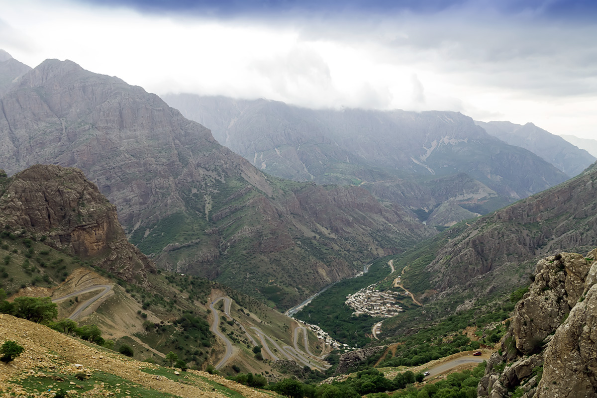


Until we got a confirmation from the locals in the village of Hawraman-al-Takht, we weren’t completely sure that we can drive through the valley and all the way towards Paveh. In 2009 the construction of the Daryan Dam on the Sirwan river begun. The dam flooded the lower part of the valley together with the old road. Now there is a new one, hugging the shores of the artificial lake, with tunnels cutting through mountains. Hawraman area is blessed by many springs and rivers. Their water mainly flows into the Sirwan. Bil (also spelled as Bel) spring or Kani Bil was nearly destroyed by the making of the dam, regardless its great significant cultural value to the Hawrami people. Kani Bil has a discharge about 3.000 to 4.000 liters of water per second and is the largest water source in Kurdistan. The river that is formed by this source is only 15m long, making it the shortest river in the world. From our cars we see its water froth as it crashes into the lake shortly before we reach the dam.


From the Daryan dam on on we leave the Hawraman valley, too soon for my taste. I just got a glimpse of its beauty and hospitality. The bad weather, mainly wind, prevented us from making the planned bivoac at the shores of the lake, and we proceeded alond another steep winding road out of the valley towards Paveh.
There was no hotel to be seen in Paveh. As the rain didn’t didn’t show any inclination to stop, we found a place along the abandoned asphalt road and set up camp. The asphalt at least prevented the tents becoming too dirty and the awning we stretched between our cars kept us dry during dinner. Next morning the clouds dispersed, the sun rose and the freshly washed mountains of Kurdistan smiled down on us through crystal clear air.

Useful information
The lenth of the route from Marivan to Paveh through Hawraman valley is about 140 kilometres, but it can easily take a full day. Not just because it is narrow and winding, but because it would be a shame to race through such beautiful country. Coordinates of the road junction at the entrance to the valley are N35° 16.727′ E46° 11.284′. Village of Hawraman-al-Takht lies at N35° 15.137′ E46° 15.588′. Kani Bil is at N35° 10.178′ E46° 20.941′. One of the best and most popular locations to photograph the hairpin road bends above village of Bulbar is N35° 14.505′ E46° 16.565′.


Iran 2018 pt.6 – Of Mouteh Wildlife Refuge – Destination: Overland
[…] long drive from the mountains of Kurdistan past Kermanshah and Khoramabad to the plateau of central Iran was tiring for passengers and drivers […]